
Columbus Approves $300,000 Contract Modification for In-House Roadway Design Software
The city council modification brings total spending on the proprietary GIS roadway tool to $890,000 across three phases since 2024.
In action taken Monday, Nov. 16, Columbus officials approved ongoing operations for municipal roadway planning. The Columbus City Council authorized the public service director to enter into a $300,000 contract modification with Indianapolis-based Cultivate Geospatial Solutions, LLC for the PAWS 2.0 software system.
The measure provides additional funding for software maintenance and enhancements.
According to city records, the contract amount including all modifications is $890,000, consisting of an original $290,000 contract from 2024, a $300,000 first modification from 2025 and the second $300,000 modification.
The custom geographic information system software is used in-house by the Department of Public Service's Division of Design and Construction to prepare construction plans for citywide roadway and pedestrian facilities.
City staff use the program to assess, generate and design pavement markings, signs and construction plans.
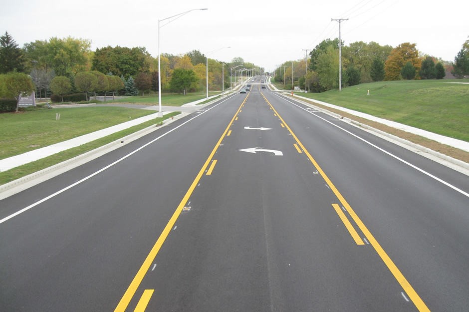
Newly painted roadway markings and turn arrows on a resurfaced street in Franklin County. Columbus uses in-house GIS software to design street striping, signage and pedestrian facilities across the city.
Credit: Decker Construction Company Image source
The city bypassed competitive bidding because the application is a custom software tool, concluding that contracting directly with Cultivate Geospatial Solutions was in the city's best interest to avoid duplicating efforts and incurring extra implementation costs.
Cultivate Geospatial Solutions originally created the tool as a subcontractor for Polygon Solutions under a contract administered by the state department of transportation before Columbus shifted administration to the Department of Public Service to contract directly with the developer.
The contract extension is funded through the city's Street Construction, Maintenance, and Repair Fund.
The modification's pricing aligns with labor, overhead and profit rates negotiated under the original contract.
City officials requested the legislation as an emergency action so maintenance and needed updates can be put into service as quickly as possible to effectively maintain the city roadway system.
City records note that additional modifications are anticipated for yearly maintenance and future enhancements.
How we know this
The sources and records behind this story, with the facts they support.
Supporting evidence (11)
The Columbus City Council authorized the public service director to enter into a $300,000 contract modification with Indianapolis-based Cultivate Geospatial Solutions, LLC for the PAWS 2.0 software system.
Read supporting passage
BE IT ORDAINED BY THE COUNCIL OF THE CITY OF COLUMBUS: SECTION 1. That the Director of Public Service be, and hereby is, authorized to enter into a contract modification with Cultivate Geospatial Solutions, LLC, 3500 Depauw Blvd Suite 10807, Indianapolis, IN 46268, for the PAWS 2.0 software system in the amount of $300,000.00, or so much thereof as may be needed, in accordance with the plans and specifications on file in the Department of Public Service, which are hereby approved.
The measure provides additional funding for software maintenance and enhancements.
Read supporting passage
This ordinance authorizes the Director of Public Service to modify the contract to add additional funding for $300,000.00 for maintenance and enhancements of the PAWS software system.
According to city records, the contract amount including all modifications is $890,000, consisting of an original $290,000 contract from 2024, a $300,000 first modification from 2025 and the second $300,000 modification.
Read supporting passage
The original contract amount PAWS 2.0 $290,000.00 (PO460193 Ord. 1952-2024) Modification No. 1 PAWS 2.5: $300,000.00 (PO516923 Ord. 1588-2025) Modification No. 2 PAWS 2.6: $300,000.00 (This Ordinance 3073-2026) The contract amount including all modifications: $890,000.00
The custom geographic information system software is used in-house by the Department of Public Service's Division of Design and Construction to prepare construction plans for citywide roadway and pedestrian facilities.
Read supporting passage
This ordinance authorizes the Director of Public Service to modify a professional services contract with Cultivate Geospatial Solutions, LLC to add additional funds for the maintenance and enhancement of the PAWS 2.0 software used to generate roadway construction plans designed in-house for citywide roadway and pedestrian facilities in the amount of $300,000.00 for the Division of Design and Construction.
City staff use the program to assess, generate and design pavement markings, signs and construction plans.
Read supporting passage
The Department of Public Service is responsible for maintaining the City's roadway system in a safe manner. The aforementioned project will allow the Division of Design and Construction to maximize efficiencies in assessing, generating, and designing pavement marking, sign, and construction plans using GIS within the PAWS system.
The city bypassed competitive bidding because the application is a custom software tool, concluding that contracting directly with Cultivate Geospatial Solutions was in the city's best interest to avoid duplicating efforts and incurring extra implementation costs.
Read supporting passage
1.3 Reason other procurement processes are not used: The current contract is a custom software solution, therefore, it was decided it is in the best interest of the city to modify this contract with Cultivate Geospatial Solutions, LLC in order to avoid having to duplicate efforts thereby costing the City extra funds to implement.
Cultivate Geospatial Solutions originally created the tool as a subcontractor for Polygon Solutions under a contract administered by the state department of transportation before Columbus shifted administration to the Department of Public Service to contract directly with the developer.
Read supporting passage
This software was developed by Cultivate Geospatial Solutions (CGS) subcontracting for Polygon Solutions under a DOT-administered contract. The Division of Design and Construction moved the contract administration to the Department of Public Service and now contracts directly with Cultivate Geospatial Solutions LLC.
The contract extension is funded through the city's Street Construction, Maintenance, and Repair Fund.
Read supporting passage
3. FISCAL IMPACT Funding for this planned expenditure is budgeted in the amount of $300,000.00 and is available within Fund 2265, the Street Construction, Maintenance, and Repair Fund.
The modification's pricing aligns with labor, overhead and profit rates negotiated under the original contract.
Read supporting passage
1.4 How cost of modification was determined: The cost of this contract modification is consistent with the direct labor, overhead, and profit rates established within the original proposal/contract as negotiated during the original contract.
City officials requested the legislation as an emergency action so maintenance and needed updates can be put into service as quickly as possible to effectively maintain the city roadway system.
Read supporting passage
EMERGENCY DESIGNATION: Emergency action is requested so that maintenance and needed updates to the system can be put into service as quickly as possible because funds need to be added to continue this contract to allow the Department of Public Service to effectively maintain the City's roadway system.
City records note that additional modifications are anticipated for yearly maintenance and future enhancements.
Read supporting passage
This is a planned modification that is necessary to cover the cost of work for yearly maintenance and enhancements of the PAWS software system. Additional modifications are anticipated for yearly maintenance and future enhancements.